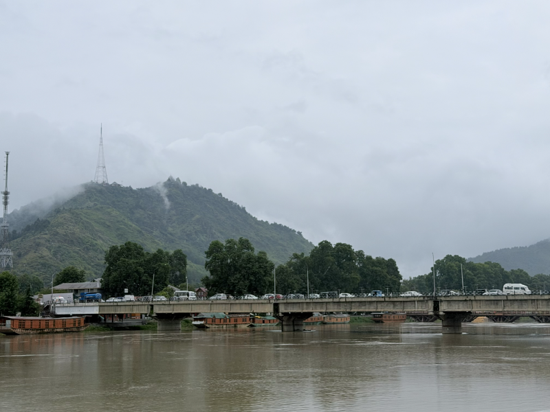
Every generation in Kashmir believes it has witnessed the greatest flood in the Valley’s history. Yet the Jhelum tells a different story. For centuries it has overflowed its banks, submerged settlements, destroyed harvests, and reshaped human lives. Kings have ruled and disappeared, capitals have flourished and declined, but the river has remained remarkably constant. Floods are not interruptions in Kashmir’s history; they are among its oldest and most enduring chapters.
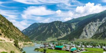
To understand floods in Kashmir, one must first understand the Valley’s geography. Kashmir is a bowl-shaped basin enclosed by the Pir Panjal and the Greater Himalayas. Geological research suggests that it was once occupied by a vast prehistoric lake whose waters gradually drained through the Baramulla gorge. What remained was a fertile intermountain valley nourished by the Jhelum and sustained by lakes, marshes, wetlands, and floodplains. Water created Kashmir’s civilization, but it also made flooding an unavoidable feature of its existence. Kashmir’s history, therefore, has always been shaped as much by its rivers as by its rulers.
This relationship between society and water was recognized long before modern science. The Nilamata Purana reveres the Vitasta, today’s Jhelum, as the Valley’s lifeline, reflecting an ecological consciousness in which rivers, springs, lakes, and wetlands sustained agriculture and daily life. Kashmir’s earliest historian also recognized nature as an actor in history. In the twelfth century, Kalhana’s Rajatarangini recorded floods, excessive rainfall, and natural calamities alongside accounts of kings and political change. Later historians such as Jonaraja and Srivara, along with Persian chronicles including the Baharistan-i-Shahi and Tarikh-i-Hasan, documented floods that devastated crops, damaged settlements, and disrupted communication. These sources demonstrate that floods were never isolated events in Kashmir; they formed part of its historical rhythm.
These chronicles also reveal how geography shaped governance. Floods affected food supplies, taxation, trade, and public welfare, making water management an essential responsibility of the state. During the reign of Avantivarman (855–883 CE), his celebrated minister Suyya undertook remarkable hydraulic works that improved the flow of the Jhelum, reduced the impact of flooding, and reclaimed cultivable land. Centuries later, Sultan Zain-ul-Abidin continued this tradition through canals and irrigation works that strengthened agriculture and commerce. Though these measures were not modern flood-control projects, they reflected an enduring understanding that Kashmir’s prosperity depended upon managing water wisely rather than merely reacting to disasters.
This lesson remained relevant as Kashmir entered the nineteenth century. Under Dogra rule, recurring floods increasingly drew administrative attention. The fertile lands of the Valley generated agricultural wealth, but repeated inundation threatened cultivation and revenue. Sir Walter Lawrence, in his classic work The Valley of Kashmir, observed that the fortunes of Kashmir were inseparable from the behaviour of the Jhelum. His observations remain relevant today: the challenge was never simply the river itself, but learning to live intelligently with it.
The devastating flood of 1893 exposed the limitations of existing flood management and marked a turning point. It convinced the Dogra administration that seasonal relief was insufficient and that long-term engineering solutions were necessary. During Maharaja Pratap Singh’s reign, the Flood Spill Channel was constructed between 1904 and 1907 to divert excess water from the Jhelum during periods of exceptionally high discharge. Stretching from Padshahi Bagh towards Wular Lake, it represented more than an engineering project. It reflected the recognition that rivers require space and that working with natural hydrology is often more effective than attempting to control rivers through embankments alone.
Engineering, however, formed only one layer of Kashmir’s traditional defence against floods. Nature itself had created a sophisticated system of protection. Wular Lake, together with Hokersar, Haigam, Narkara, Mirgund, and other wetlands, functioned as natural storage basins. During heavy rainfall, these wetlands absorbed large quantities of water, slowing the flow of the Jhelum and reducing downstream flooding. Earlier generations may not have described these landscapes in the language of environmental science, but they understood their practical value. Wetlands were not wastelands waiting to be reclaimed; they were essential components of Kashmir’s ecological infrastructure.
The twentieth century repeatedly tested these natural and engineered systems. Major floods occurred in 1903, 1928, 1957, 1959, 1973, 1992, and later years. Each damaged homes, fields, roads, and public institutions. Each generated official reviews and promises of improved preparedness. Yet the historical cycle remained consistent: public attention peaked during disaster and declined as floodwaters receded.
Meanwhile, Kashmir itself was changing. Population growth, urban expansion, and rising developmental pressures transformed the landscape. Srinagar expanded beyond its traditional limits. Wetlands that had protected the city for centuries were encroached upon or reclaimed for residential colonies, commercial complexes, roads, and public infrastructure. Floodplains narrowed, drainage channels were blocked or neglected, and forest degradation in upper catchments reduced the Valley’s capacity to absorb excess rainfall.
The consequences became tragically evident in September 2014. Following several days of exceptionally heavy rainfall across the Jhelum basin, river levels rose beyond danger marks, inundating vast areas of Srinagar and several other districts. Entire neighborhoods disappeared beneath floodwaters. Hospitals, schools, government offices, businesses, and communication networks ceased to function. More than a million people were affected. For many Kashmiris, it was the most devastating natural disaster of their lifetime.
History, however, encourages a more careful interpretation. The flood itself was natural; the scale of the disaster was shaped by decades of human decisions. Investigations after the floods pointed towards unprecedented rainfall, encroachments upon floodplains, degradation of wetlands, inadequate maintenance of the Flood Spill Channel, blocked drainage systems, and unplanned urban development. Nature provided the trigger. Society magnified the consequences.
Perhaps the most enduring lesson of 2014 was that rivers eventually reclaim the space denied to them. The Jhelum did not suddenly invent a new path through Srinagar. It reoccupied areas that had historically formed part of its floodplain. The disaster was not merely a hydrological event; it was a collision between historical geography and modern land use. The river remembered what people had gradually forgotten.
Today, climate change has introduced another layer of uncertainty. Scientific evidence indicates that the Himalayan region is experiencing increasing climatic variability, including more intense rainfall events, changing snowfall patterns, accelerated glacier retreat, and rising temperatures. These changes do not alter the basic geography of Kashmir, but they increase the frequency and intensity of extreme weather events within an already fragile landscape.
The lesson running through Kashmir’s history is clear: floods cannot be prevented entirely, but their impact depends on how wisely society respects the natural systems that have shaped the Valley for centuries. Living with the Jhelum, rather than attempting to overpower it, remains the most enduring lesson that history offers.
The writer is a South Asian history researcher whose work explores Kashmir’s historical landscapes, political memory, and overlooked voices. Shabeerhistory18@gmail.com