

Jammu: The Jammu and Kashmir administration on Saturday approved the formation of a three-tier committee to delineate and demarcate different kinds of land, which do not form a part of water channels but have been mentioned in revenue records as such.
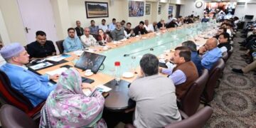
The administrative council, which met under the chairmanship of Lieutenant Governor Manoj Sinha, approved the procedure for delineation and demarcation of “gairmumkinkhads/daryas/nallahs”, an official spokesman said.
The exercise will be conducted in a phased manner in districts of Jammu, Samba and Kathua in three months and remaining districts in one year, he said.
The spokesman said the decision would give major relief to people who are suffering because of erroneous or misleading entries of such water bodies in their revenue records.
“This will put to an end to litigations pending in various courts besides allowing owners of such lands to transact and carry out various economic or non-economic activities allowed as per land use under the master plans of development or local areas,” he said.
The approved procedure provides for khasra-wise delineation by the internal departmental committees using GPS for generation of digital maps, conducting actual spot verification to establish desirable width of water course or channels especially in proprietary lands, and removal of illegal encroachments on identified water courses through remedial action, the spokesman said.
The council approved the constitution of a three-tier committee to oversee the exercise at district, division and Union Territory level, headed by deputy commissioner, divisional commissioner and chief secretary, respectively, he said.
The district-level committees would be mandated to conduct khasra-wise survey of all land recorded as ‘gairmumkinkhads, daryas, nallahs’ and prepare maps accordingly, delineate lands which do not form part of any water course or source or annual drainage system as per spot verification, the spokesman said said.
He said the district-level committees would also establish baseline for conducting the delineation exercise as per the status of the land in records of 2010.
This will be vis-a-vis status of the land with respect to the previous settlement of records, ‘MisalHaqiat’, and recommend and take remedial action for the illegal encroachments or constructions actually obstructing the natural flow of water in the channel or course recorded as ‘gairmumkinkhads, daryas, nallahs’, the spokesman said.
The committees at divisional level would have a supervisory role and will closely monitor and review the exercise to resolve issues of coordination between two districts, inter departmental consultations and any other assistance which may be required by the district level committees, he said.
The progress will be reviewed by the UT Level Committee on a monthly basis, the spokesman said.


